The Most Dependable Marine Gravity and Magnetic Acquistion with the highest efficiency in the industry.
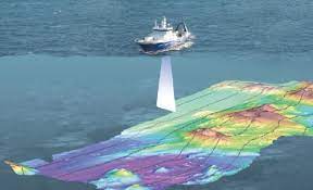
Marine Gravity and Magnetic Acquisition
As leaders in marine gravity and magnetic acquisition, we provide the largest selection of equipment, dependent on client requirements. Gravity meters available are ZLS air damped meters, ZLS Dynamic fluid damped meters, and DGS magnetically damped meters. Magnetometers available are Marine Magnetics SeaSPY Magnetometers and Geometrics G-882 Magnetometers. Magnetometers include altimeter and gradiometer options with armored cables for challenging environments. Due to our unparalleled inventory, each system is provided with a full redundancy of spares.
Austin Exploration has developed extensive training programs to ensure highly qualiified personnel for each project. Training focus includes HSEQ along with furthering technical knowledge.
Gravity and Magnetic Compilation Services
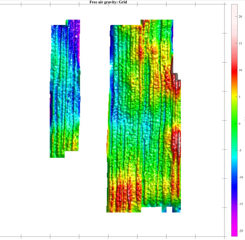
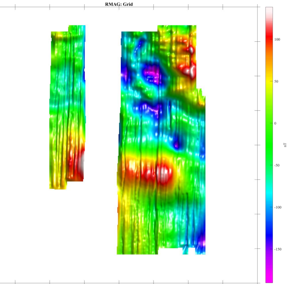
At Austin Exploration, we’re committed to delivering exceptional data quality and reliable results. With over 40 years of experience, our proven processes ensure precise and efficient data acquisition. Our gravity and magnetic compilation begins with a thorough analysis of navigational data, incorporating gravity readings, water depth, and other key metrics. We apply the Eötvös correction to account for motion-related gravity variations, followed by a detailed assessment of ocean-bottom sediment density to accurately apply the Bouguer correction. Throughout the process, we perform all necessary terrain corrections and seamlessly merge gravity data at traverse intersections to minimize distortion. Every project is accompanied by a comprehensive report outlining our methodology and findings, giving clients full transparency and confidence in the results.
Gravity and Magnetic Interpretation
Our Gravity and Magnetic Interpretation service delivers precise subsurface modeling through advanced three-dimensional analysis of gravity data. We begin by constructing a Regional Gravity Map that represents the gravity response to density variations within the basement rock. This regional field is subtracted from the Bouguer gravity field to isolate residual gravity anomalies. We then integrate additional datasets—such as residual or derivative data, density contrast information, and geometric model references—into specialized software to generate a detailed residual grid. This grid defines a network of vertical prisms of variable height on a reference surface. The resulting model provides a structural surface whose computed gravity response accurately matches the observed data. Final outputs can be contoured in either feet or meters, providing a clear visualization of subsurface structures for exploration and analysis.
Equipment Rental and Support Available
Marine Magnetometer Systems
Marine Gravity Meter
Land Gravity Meter, Lacoste and Romberg
Technical support for equipment
Equipment training